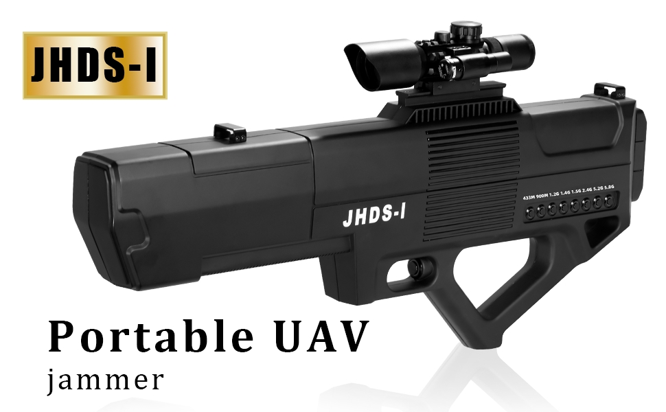

As a portable Unmanned Aerial Vehicle (hereinafter referred to as “UAV”) control equipment based on the principle of transmitting high-intensity electromagnetic waves, functions in the flight control system and satellite positioning receiver of various small and medium-sized civil UAVs, and makes them fail by blocking normal communication signals.
This equipment has 420-450MHz,840~930MHz, 1180~1280Mhz, 1400-1480MHz,1550~1620Mhz, 2400~2500Mhz, 5150-5250MHz,5715~5850MHz. The flight control blocking frequency of six frequency bands, as well as the GPS/QZSS/GLONASS/Galileo satellite positioning blocking frequency, can make the controlled UAV lose control, return, drive away, forced landing or crash through reasonable operations.
This device adopts handheld portable design, with high-strength PC+ABS shell, highly integrated microwave circuit structure and compact miniaturized antenna design. It has the characteristics of firm body, good heat dissipation, easy to carry and use, and long control distance. The device uses a rechargeable lithium battery pack with strong battery life.
This equipment adopts DSSS/FHSS dual-standard interference source, with all-solid-state microwave integrated circuit MMIC technology, and high-density SMT surface mount technology, which has high reliability and can adapt to normal work in severe cold and high temperature environments.
Parts list
Before starting use, check that all of the following items are included in the device package. If anything is missing, please contact your dealer.
| Name | Quantity | Note |
| Host computer | 1 | |
| Sight | 1 | With infrared function |
| lithium battery | 1 | Multiple batteries can be configured |
| Charger | 1 | |
| Cable | 1 | |
| Strap | 1 | |
| Instructions | 1 | |
| Equipment case | 1 |
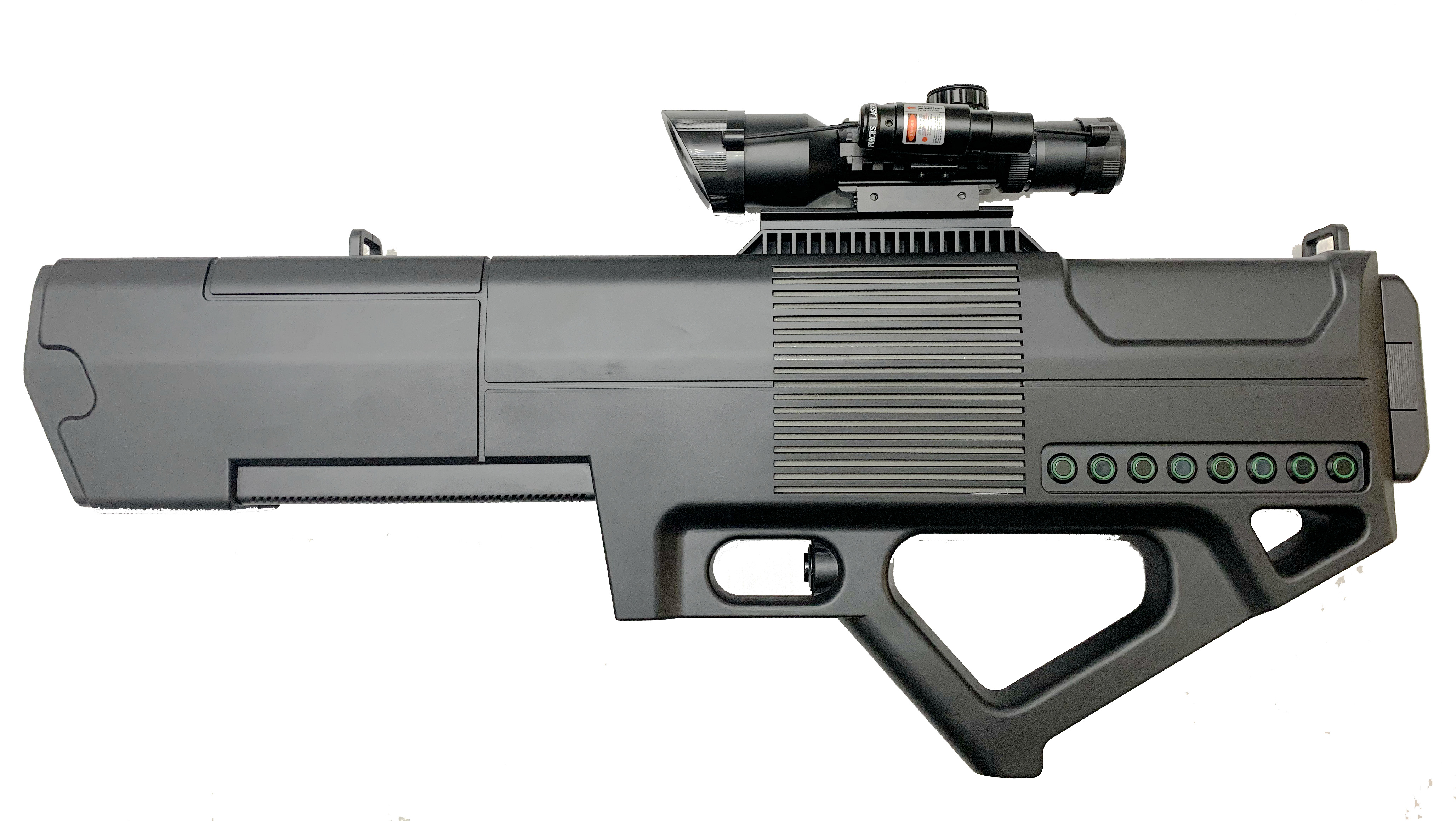
Product display

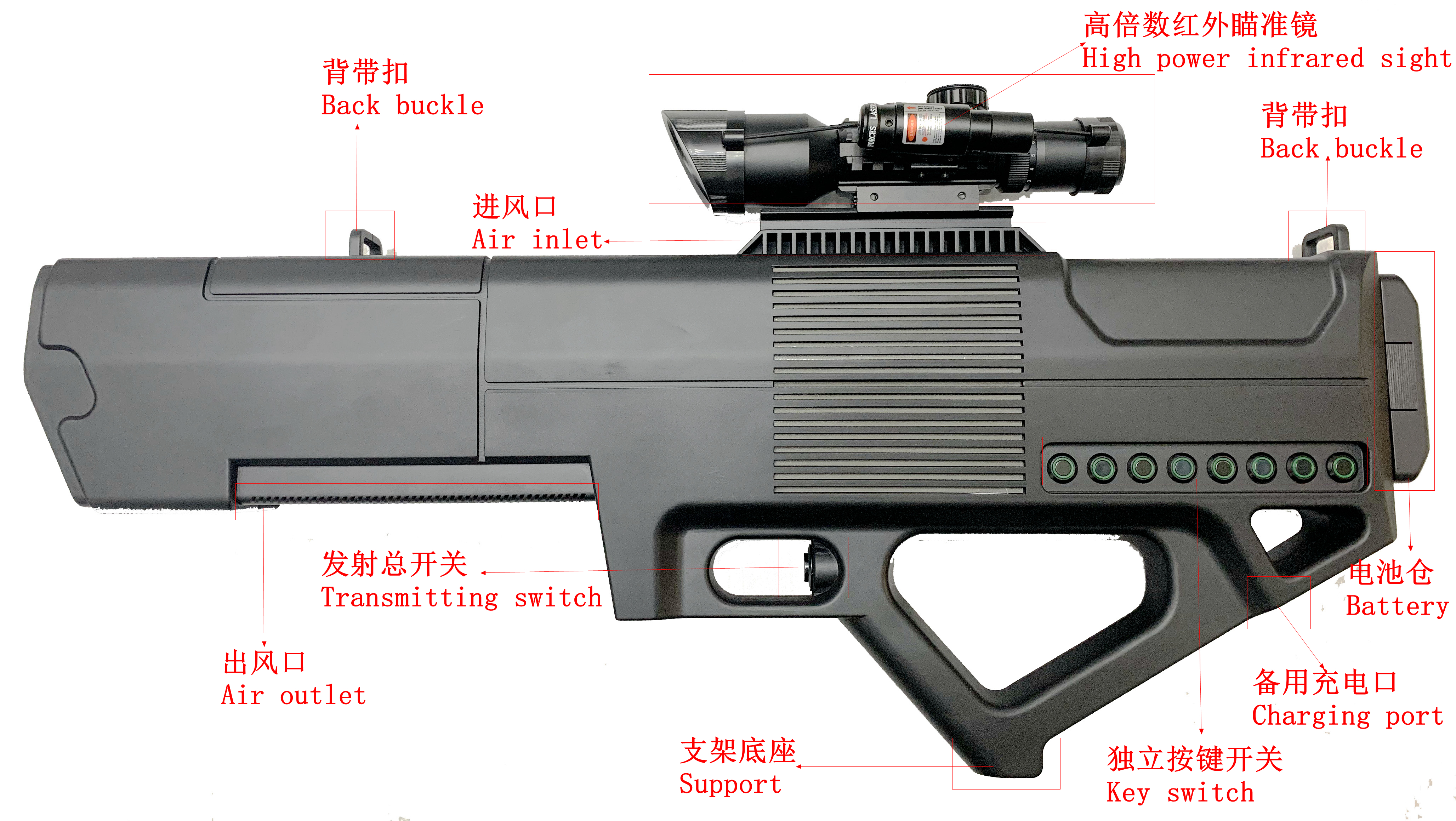
Product function introduction

system at the end of the battery, including battery voltage, power and temperature management and control functions, which can be customized to set the battery temperature and high and low voltage alarms, with buzzer alarm sound.


Charge the battery with the charger
1. The charging interface is at the end of the battery and the battery display is together.
2.Connect the charger to the AC power through the power cord, and the indicator light of the charger will turn green;
3.Insert the output plug of the charger into the charging interface of the battery pack;
4.The indicator light on the charger turns red and charging starts;
5.When the charging is finished, the indicator light on the charger will turn green and stop charging automatically.
Sight of action
The distance of interference depends on the ratio of the strength of the interference signal reaching the UAV to the strength of the remote control flight control signal or satellite navigation signal reaching the UAV. Among them, the strength of the satellite navigation signal is basically a fixed value, so the overall working distance is only related to the position of the UAV and the remote control. At the same time, since this device adopts a directional antenna, its operating range is related to the direction of the antenna. The maximum operating distance is in the maximum radiation direction of the antenna. When it deviates from the maximum radiation direction, its operating distance will be correspondingly reduced.
The interference range between the flight control signal and the satellite navigation signal is described as follows.
Flight control signal
The actual usage scenarios are as follows:

h1: Distance between the remote control and the device to be measured
h2: Vertical flight height of UAV (from the ground)
d1: The horizontal distance between the remote control and the UAV
d2: The horizontal distance between the device under test and the UAV
Among them, h1 is generally about 1.5 meters, which is negligible compared with the flying height h2 of the UAV. The actual test range of flight control signal interference is as follows:
2.4GHz frequency band flight control signal interference action distance (signal maximum direction)
| d1=50m | d1=100m | d1=200m | d1=500m | |
| h2=25m | 230m | 390m | 710m | -- |
| h2=50m | 260m | 440m | 820m | 1760m |
| h2=100m | 430m | 560m | 880m | 1770m |
| h2=200m | 790m | 860m | 1090m | 1870m |
| h2=500m | 1690m | 1760m | 1720m | 2190m |
5.8GHz frequency band flight control signal interference action distance (signal maximum direction)
| d1=50m | d1=100m | d1=200m | d1=500m | |
| h2=25m | 310m | 520m | 980m | -- |
| h2=50m | 360m | 620m | 1150m | -- |
| h2=100m | 630m | 780m | 1230m | 2170m |
| h2=200m | 1110m | 1270m | 1520m | 2310m |
| h2=500m | 2050m | 2060m | 2220m | 2590m |
(1)The working distance in the table is the horizontal distance (d2) between the control equipment and the UAV. The lack of data leads to insufficient flight altitude, and the normal flight control signal of the UAV is unstable.
(2)All frequency band UAVs used in the test meet the relevant national requirements, and the quality of the finished UAVs and supporting remote controls is qualified. The transmission power of the remote control has been tested to reach the upper limit of the country's transmission power for this type of equipment.
Satellite positioning signal
When interfering with satellite positioning signals, the satellite signal received by the UAV is a constant field strength signal, basically irrelevant to the position of the UAV. However, the signal arrival strength of various satellite positioning systems is slightly different, but the overall difference is not large, so only the actual test results of GPS satellite positioning signals are given below, and the interference distance to other satellite positioning signals is basically the same.
GPS satellite positioning signal interference distance (signal maximum direction)
| h2=25m | h2=50m | h2=100m | h2=200m | h2=500m |
| 610m | 750m | 750m | 770m | 630m |
The working distance in the table is the horizontal distance between the control equipment and the UAV (d2)
When the height of the UAV is low, ground absorption will affect the interference distance to a certain extent; when the height of the UAV is high, the horizontal distance of the actual distance will also be reduced due to the geometric relationship. However, in both cases All can meet the actual use needs.
Personal protection - Avoid radiation damage
This device works on the principle of emitting high-intensity electromagnetic waves. The harm of any high-intensity electromagnetic waves to the human body should be taken seriously.
At present, there is no clear conclusion on the harm of electromagnetic waves to the human body in the world, but there are relevant standards. There are also related standards such as GB8702-88 in China.
This equipment has been carefully designed, using a strong directional antenna, and optimized by computer-aided design technology, so that the front-to-back ratio of the antenna unit as a whole has reached more than 17dB. In other words, the electromagnetic wave radiation intensity at the rear of the antenna is 1/50 of the front. At the same time, an irregular shape medium is used to intervene in the electric field, with low antenna side lobe effect, thus greatly reducing the radiation impact on the human body. Its electromagnetic radiation intensity to the operator is far lower than the derivation limit of public exposure specified in the national standard.
(For more details, please refer to the relevant test report)
Technical specifications
(1)Working frequency: 420-450MHz,840~930MHz,1180~1280MHz,1400-1480MHz,1550~1620MHz,2400-2500MHz,5150-5250MHz,5715~5850MHz。
(2)Output power:140W-160W
(3)Signal style: DSSS (spread spectrum) / FHSS (frequency hopping).
(4)Antenna gain: 38-40dB。
(5)Battery capacity: 6800mah (one battery, multiple configurations).
(6)Endurance time: ≥60 minutes (continuous launch) ≥600 minutes (30s launch, 90s stop)
(7)Product weight: host 2.4kg,Battery 0.95kg,Sight 0.47Kg。
(8) Product size: host 610*54*223mm,Battery 174*98*52mm,Sight 230*65*85mm
(9)Working mode: independent single-channel launch.
(10) Sight magnification: 3-10 times.
(11) Control distance: flight altitude 100M control distance ≥ 1500M, Flight altitude 200M control distance ≥ 2000M.
